Airlie Beach Facts Most Visitors Miss
The short answer. The best pool in town is free and stinger-proof. The main marina has had another name. Two airports share almost the same name, the famous heart-shaped reef was found by a pilot, and the reefs you snorkel from town are the Great Barrier Reef too. Here are the facts that change how you plan.
1. The town's best swim is free
There is no ticket to Airlie Beach, and its most-used place to swim costs nothing. The Airlie Beach Lagoon is a public pool of about 4,000 square metres on the foreshore, open every day from 4:30am to 6pm with lifeguards all year. Tourism Whitsundays calls it completely safe from stingers and marine wildlife. For a town on a tropical sea, that matters more than it sounds.
2. The main marina used to be called something else
Coral Sea Marina, where most boats leave, was previously Abell Point Marina, and the old name has not quite gone. The jet boat listing still says the ride starts at Abell Point Marina, while its meeting point is Coral Sea Marina's South Village. If your confirmation names Abell Point, you are going to the same place. Tourism Whitsundays lists the marina at 520 wet berths.
3. Two airports, nearly the same name
This is the fact that sends taxis to the wrong place. Both airports carry the word Whitsunday, and they do different jobs.
| Whitsunday Coast Airport | Whitsunday Airport | |
|---|---|---|
| Where | Proserpine | Flametree, near town |
| What flies from it | Airline flights | Scenic flights and the helicopter |
| Getting there | About 40 minutes; buses meet every flight | Courtesy bus, on request |
| Also listed as | Proserpine airport | Shute Harbour Airport |
Book your flight into Whitsunday Coast Airport; book your reef flight from Whitsunday Airport. The routes are on the how to get there page.
4. Heart Reef was found by a pilot
Tourism Whitsundays says Heart Reef was discovered in 1975 by a local pilot. That is fitting, because the air is still the only way most people see it. It lies in Hardy Reef, about 80 km east of town, and none of the boat days we list goes there. The hour-long scenic flight circles it, from $253.
5. The fringing reefs are the Great Barrier Reef too
Many visitors assume a snorkel near the islands is not the real thing. Tourism Whitsundays puts it differently: coral grows straight off the islands, and these fringing reefs sit inside the same Marine Park as the outer reef. The outer-reef trip from town, by Tourism Whitsundays' account, is to a pontoon at Hardy Reef about three hours offshore. What you snorkel from town is the fringe, and it counts. The snorkel days are compared on Airlie Beach snorkeling tours.
6. Stingers are not only a summer problem
QPWS says dangerous marine stingers, sharks and crocodiles can be in the sea at all times of the year. Tourism Whitsundays gives the higher-risk window as October to May. The Irukandji is one of them. That is why the snorkel boats hand out full-body suits, and why Boathaven Beach has a stinger net in summer.
7. No road goes to Whitehaven Beach
You cannot drive to the most famous beach in the region. QPWS lists access by boat, canoe or kayak only, and the day-use area is about 40 km by sea from Shute Harbour. That is why your beach day is mostly a boat day. The routes and the days are on Airlie Beach tours to Whitehaven Beach.
8. There is no long-running weather station in town
The Bureau of Meteorology had an Airlie Beach station only from February to September 2004. The nearest long record is Proserpine Airport, about 25 km inland. Its figures make September the driest month, at 17.7 mm on average, and February the wettest, at 351.7 mm. Island weather is measured on Hamilton Island. Both are laid out on the Airlie Beach weather page.
9. Boats must stay 300 metres from the whales
Humpback whales use these waters from around May to September, with numbers peaking in August. Most of the water around the islands lies inside the Whitsunday Whale Protection Area, where vessels keep at least 300 metres clear. Boat passengers see whales at a distance; from a small plane you look down on them. One flight reviewer's pilot pointed out breaching whales on a lunchtime flight.
10. The coral spawns by the moon
If you visit from October to December, you are there for coral spawning, which follows the full moons, according to Tourism Whitsundays. It falls inside the higher-risk stinger window, which runs from October to May. How the seasons line up is on the best time to visit page.
11. The waterfall can stop
Cedar Creek Falls, about 30 minutes from town, is free, with no entry fee. It is fed by rain, and in dry spells it may slow to a trickle or stop. The Cedar Creek bus says the waterfall may not be running from August to October, though the waterhole is there all year. Diving and jumping from the rocks is not permitted, and the rocks are slippery.
12. The hills behind town are a rare rainforest
Conway National Park rises straight behind Airlie Beach. Tourism Whitsundays says it protects the largest area of lowland tropical rainforest in Queensland outside Tropical North Queensland, and that its cliffs form a 35 km backdrop to the Whitsunday Passage. You pay nothing to walk it, and a 3.9 km track takes you up to Coral Beach and The Beak Lookout. The walks are on the things to do page.
13. It is a long way from anywhere
Tourism Whitsundays puts the Whitsundays about 1,120 km north of Brisbane and 630 km south of Cairns. That is why most visitors fly in, and why a road trip up the coast needs more than a weekend. Two airports serve it: Whitsunday Coast Airport on the mainland, and one on Hamilton Island. Plan the travel days as carefully as the days on the water.
14. Nobody agrees how many islands there are
QPWS says Whitsunday Islands National Park protects 32 islands. Tourism Whitsundays speaks of 74 in the Whitsundays as a whole. Both are right, because they count different things. For a visitor the number that matters is smaller: the handful the day boats land on.
One more: whose country this is
QPWS says the Ngaro people have lived in the area for over 9,000 years. On the raft day, one reviewer praised a guide's First Nations account of how the lookouts formed. A guide who tells that story is worth asking for.
Four of these facts change what you book, so here they are again as a checklist:
- Flights leave from Whitsunday Airport, not the airline airport at Proserpine.
- Heart Reef is seen from the air, never from a boat day out of town.
- A suit goes on for every swim in the sea, whatever the month.
- The waterfall may be dry from August to October; the waterhole is not.
Where each boat lands is in the island-by-island guide.
See the reef the boats cannot reach
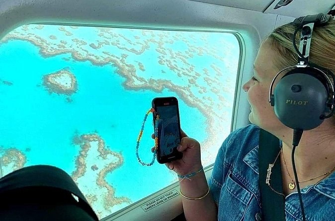
1hour Scenic Flight Heart Reef, Whitehaven Beach, Hill Inlet, GBR
One hour in a small plane over the heart-shaped reef, the inlet and the beach, with a window seat for everyone and a courtesy bus from town. It does not land, and check-in is 45 minutes before.
From $257 per person
Check Availability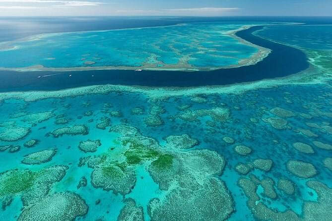
Heart Reef & Whitehaven Rest and Relax - ~2.5Hr Helicopter Tour
A private helicopter for two or three that flies over the reef and lands on the beach for about 90 minutes. Snacks and drinks are in the fare, and at least two must book together.
From $1,112 per person
Check Availability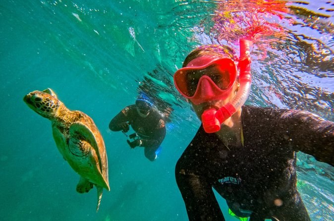
Snorkel & Whitehaven Beach Eco Cruise, Lunch | From Airlie Beach
Eight hours on an air-conditioned catamaran to the southern end of the beach, with up to four hours on the sand on the beach-only ticket and a guided walk to the southern lookout. No stop at the inlet.
From $173 per person
Check AvailabilityNext: Traveling with children? Read the guide to ages, heights and boats. Every fare sits side by side on Airlie Beach Tours.